
You are here: Home : Maps
Maps
![]() View maps in the PDF file format with the free Adobe Reader software. If you are unable to view or find what you need, contact P&TS and we'll fax or mail you the items you request.
View maps in the PDF file format with the free Adobe Reader software. If you are unable to view or find what you need, contact P&TS and we'll fax or mail you the items you request.
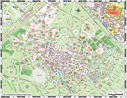 Parking and Circulation Map / Campus Map (PDF, 3 MB)
This map shows the main campus and most of the different parking opportunities available.- Printed copies are available in packages of 100 from Staples Advantage, the CWA vendor for office products at Stanford. (Search for item: Z87954401 or "campus map" in SmartMart within Oracle iProcurement.)
- Other campus maps are available from the "Maps & Directions" page of the university website.
- Marguerite System Map (PDF, 665 KB)
This map shows the campus and the main Marguerite routes.
- Pedestrian Zone Access Map (PDF, 1.3 MB)
- Pedestrian Zone Access/Distance Map (PDF, 1.4 MB)
- Service & Delivery Map (PDF, 2.3 MB)
This map shows the quickest and safest routes to make a service call or delivery.
- Visitor Information Services Map (PDF, 1 MB)
This map shows the areas on campus where one-day Visitor scratchers are valid and the locations of Pay Parking areas. For other meter locations, view the campus map above.
- Truck Route Map (PDF, 134 KB)
This map shows the official truck routes in the Stanford area.
- Bus Parking & Loading Map (PDF, 2.2 MB)
This map shows where tour and school buses can load and unload passengers visiting the campus.
- Carpool Parking Map (PDF, 2.3 MB)
This map shows the designated parking areas for carpools on campus.
- PS-6 Walking Times Map (PDF, 1.9 MB)
This map shows estimated travel times when walking from Parking Structure 6 to surrounding areas of the campus.
- Stanford University Campus Access Guide
An online system of maps detailing wheelchair accessibility and other disability access information (including parking options) for campus venues.
- Bicycle route maps are located on the Bicycling page.
Parking & Transportation Services is located at 340 Bonair Siding, Stanford, CA 94305-7255.
Hours: Monday-Friday, 7:30 a.m. - 5 p.m. Phone: 650.723.9362. Fax: 650.724.8676. Email: [email protected]
Hours: Monday-Friday, 7:30 a.m. - 5 p.m. Phone: 650.723.9362. Fax: 650.724.8676. Email: [email protected]
Parking and Transportation Services is a department of Land, Buildings & Real Estate
Copyright © The Board of Trustees of The Leland Stanford Junior University. All Rights Reserved.