


Shaping the West
DESCRIPTION:
By the end of the 19th century, railroads stretched across the United States from coast to coast connecting cities and peoples. The railroads were the conduits along which people, traffic, power, money, and influence flowed towards the West. They represented, if not always in reality, then at least in the public's imagination, the great, indelible link to the rest of the world and to the progress of the future. As transcontinental travel and shipping became easier, people's experiences of space and time changed dramatically. The Shaping the West Project is developing tools to represent and analyze visually how and to what degree the railroads created new spatial patterns and experiences in the 19th century American West.
The Shaping the West project in the Spatial History Lab at Stanford University was established to explore the growth and influence of the railroads on the Western United States. While the eventual goal is to reconstruct a network that includes every historic rail line in the West before 1900, the project puts particular emphasis on the railroads of California and on those around San Francisco. The project connects data gathered from more traditional historic sources (letters, freight tables, books, newspapers, accident reports, ledgers) to its specific geographic location using historic maps and surveys georeferenced in ArcGIS. This spatial history, as we call it in the lab, examines how historic perceptions of space in the newly settled West were influenced by more than Cartesian geography: specifically by patterns of land holding, commerce, and communication.
We started by examining rates for commodities shipped on rail lines in the West to see how these rates influenced California's development and how what might be called "cost space" (measured by the cost of shipping commodities) differed from an absolute space measured in miles. Our results led us to ask new questions: why, for example, do railroad rates act to erase rivers - eliminating them as competing means of transportation - in some areas while other rivers a short distance from railroads effectively compete for cargo? Why is geographic distance as a factor in transportation virtually erased in some communities while others of similar size and composition see the effects of distance actually increased? In short, how do railroad rate tables act as a kind of software for the hardware of railroad lines in order to control the construction of lived space? We are eager to see how visualizations such as this one can illustrate and help us understand changes in historical space and their social, political, and economic results. Our goal is that models such as this one will prove useful for other research and teaching applications.
In other projects, our research assistants explored California's changing manufacturing and agricultural landscape along the railroads and studied the geographic distribution of stockholders in the Union Pacific Railroad Company. They are examining the temporal and spatial patterns of accidents along the railroads and investigating the effect of the railroads and infrastructure on local development in Fresno County in 1891.
Pairing tabular data, like census reports and land patents, with geographic data allows us to ask spatially relevant questions. Which stretches of rail were the most dangerous? Was one railroad profession more at risk of death or injury than another? How did the railroads affect settlement in the counties immediately adjacent to the railroads? What happens to these populations over time as more transportation and irrigation options became available?
We use Geographic Information Systems (GIS), spatial analysis and visualization graphical representation algorithms to visually manipulate maps and graphs. We intend our projects to be both a proof of concept and a tool that can be put to immediate use in research and teaching spatial concepts in history. We look forward to sharing our results and data over the web and in public forums.
Former Research Assistants:
Sam Azure, Emily Brodman, Kevin Fischer, Kimia Habibi, Eli Katz, Otto Murphy, Cameron Ormsby, Toral Patel, Aaron Peterson, Jess Peterson, Jeremy Schreier, Julia Schubach, Peter Shannon, Eleanor Wilking, Natalie Chladek, Bea Gordon, Rebecca Jacobs, Evgenia Shnayder, John Watson, Jordon Wappler


Show All
Applied Filters: None

Colorado Railroad Accidents, July 1884 - June 1885
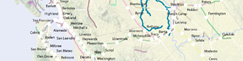
Extent of Digitized Rail
Exports from Colorado by Station in 1885
Population Density in the United States from 1790 to 2000
Per Capita Income in the United States: 1880-1910
Transcontinental Railroad Development, 1879-1893

Railroaded
What is Spatial History?
Speculative Spaces: Land Speculation and Social Formation in Two California Counties
Land Speculation in Fresno County: 1860-1891
When the Loss of a Finger is Considered a “Minor” Injury
A Data Model for Spatial History
Union Pacific Shipping from Nebraska: Forwarded/Received
Union Pacific Shipping from Nebraska: East/West
Tracing Railroad Directors, 1872-1894
Railroad Repeats: The Alfred A. Hart Photo Project
Cattle Production in the American West, 1867-1935
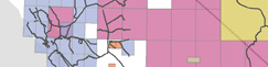
Quad Index
California Railroad Commission,
Station Construction Data, 1850-1900
Station Construction Data, 1850-1900
Western Railroads and Eastern Capital: Regional Networks on Railroad Boards of Directors, 1872-1894

Distribution of Union Pacific Stockholders by City (1869)

The Expansion of the Western Railroad
The Central Pacific and Transcontinental Eleven Step:
How to Run a Transcontinental Railroad
How to Run a Transcontinental Railroad
Patterns of Change in Railroad Company Board Members, 1872-1894
The Rise in the American Railway Union, 1893-1894
Seeing Space in Terms of Track Length and Cost of Shipping
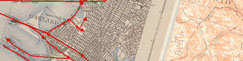
Examples of Digitizing Rail from Historic USGS Quads